Competitions
Velodom 120
Velodom 60
Velodom 30
Courses
Pro race
May 17, 2026
Registration
Search
Menü öffnen
Results
Photos
Expo
Starter list
Shop
de
en
Menü öffnen
May 17, 2026
Anmelden
de
en
Competitions
Velodom 120
Velodom 60
Velodom 30
Courses
Pro race
Results
Photos
Expo
Starter list
Shop
Startseite
Courses
Google Maps courses
Courses
Course information
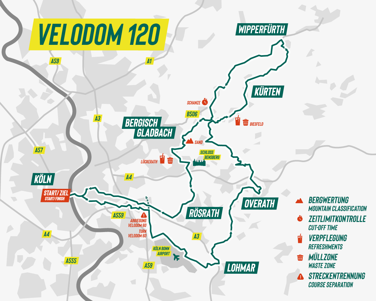
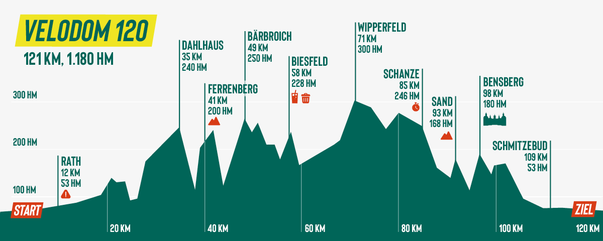
Velodom 120
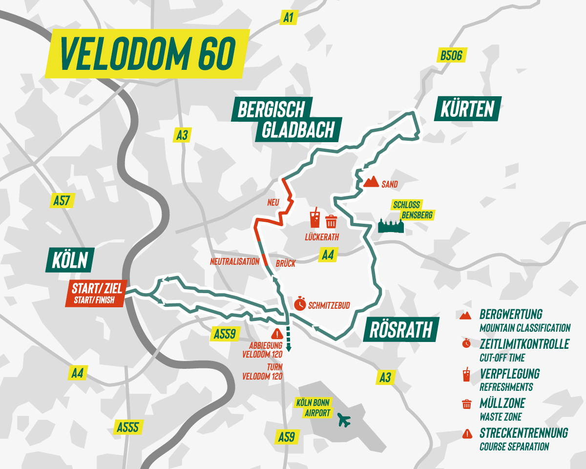
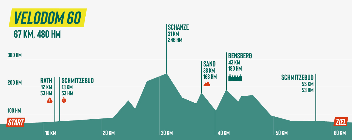
Velodom 60
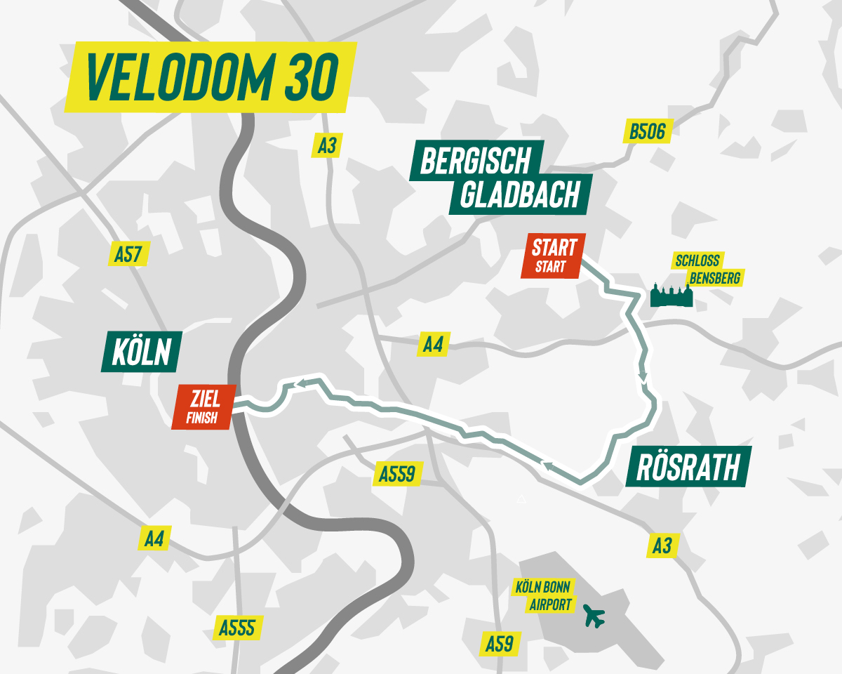
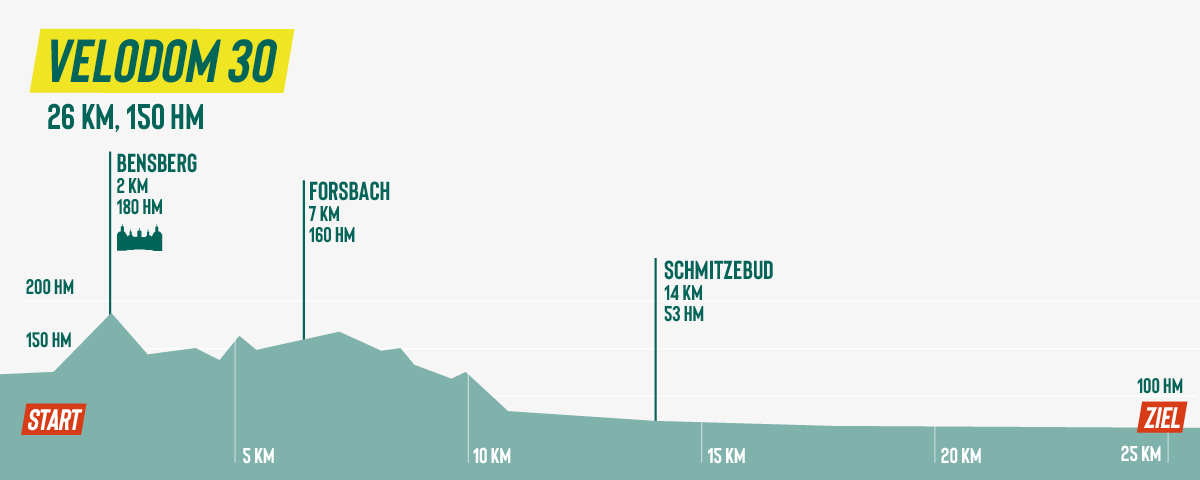
Velodom 30
Downloads
Velodom 120 course map
Herunterladen
Velodom 120 elevation profile
Herunterladen
Velodom 120 .gpx file
Herunterladen
Velodom 120 .gpx file – training session
Herunterladen
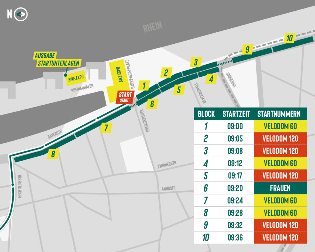
Starting area
Herunterladen
Finish area
Herunterladen
Course separation
Herunterladen
Event points
Herunterladen
Roadbook
Herunterladen
Downloads
Velodom 60 course map
Herunterladen
Velodom 60 elevation profile
Herunterladen
Velodom 60 .gpx file
Herunterladen
Velodom 60 .gpx file training sesssion
Herunterladen
Starting area
Herunterladen
Finish area
Herunterladen
Course separation
Herunterladen
Event points
Herunterladen
Downloads
Velodom 30 course map
Herunterladen
Velodom 30 elevation profile
Herunterladen
Velodom 30 .gpx file
Herunterladen
Velodom 30 .gpx file – training session
Herunterladen
Starting area & travel
Herunterladen
Finish area
Herunterladen
Event points
Herunterladen
Travel to start/finish
Bike
VRS stop Ubierring
DB stop Cologne main station
Waze
Google Maps
What3Words: tumble.apples.fork
Course of the pros
– from Cologne into Bergisches Land
start in Cologne’s Rheinauhafen
across mountainous Bergisches Land
long straights, short ascends
legendary cobblestone passage
to Bensberg Castle
spectacular finish in Cologne
View course